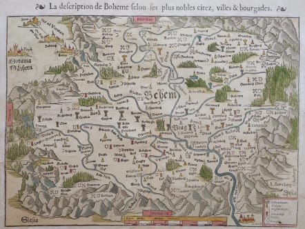
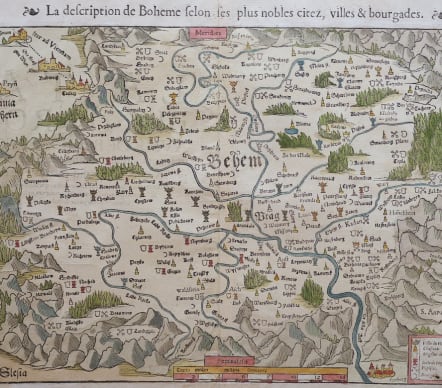
LA DESCRIPTION DE BOHEME
£235
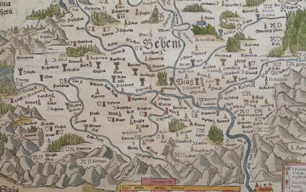
Early good woodcut map of Bohemia is oriented with north to the bottom. Prague is shown near the center of the map and the road to Vienna is depicted at top left. The exaggerated mountains and forests are typical of the early woodblock maps. This is an early map to show the encroachment of the Ottoman Empire into Europe. The map legend at bottom right, which in some examples identifies the symbols used to distinguish the cities and towns as either controlled by the Bohemian monarchy or the Turks and also whether it is Hussite or Catholic, is left blank in this example. Alternate French title on verso.
Good hand colour
Very good condition
References: Shirley (BL Atlases) T.MUN-1d #9.
code : M5511
Cartographer : Sebastian Munster
Date : 1550c Basel
Size : 26*36 cms sheet 33*40 cms
availability : Available
Price : £235
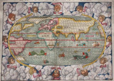
Originally a scholar studying Hebrew, Greek and mathematics, Sebastian Munster (1489-1552) eventually specialised in mathematical geography and cartography. It was this double ability - as a classicist and mathematician - that was to prove invaluable when Munster set himself to preparing new editions of Solinus’ “Memorabilia” and Mela’s “De Situ Orbis”, two classical descriptive geographies containing maps, and his own two greatest works, the “Geographia” and “Cosmographia”. These reflect the widespread interest in classical texts, which were being rediscovered in the fifteenth century, and being disseminated in the later fifteenth and sixteenth century, through the new medium of printing.
The “Geographia” was a translation of Ptolemy’s landmark geographical text, compiled in about 150 AD., illustrated with maps based on Ptolemy’s calculations, but also, in recognition of the increased geographical awareness, contains a section of modern maps. In the first edition of the “Geographia”, Munster included 27 ancient Ptolemaic maps and 21 modern maps, printed from woodblocks. Subsequent editions of the “Cosmographia” were to contain a vast number of maps and plans.
One consequence of Munster’s work was the impetus it gave to regional mapping of Germany, but Munster was also the first cartographer to produce a set of maps of the four continents on separate maps. Most importantly, through his books (the “Geographia” and “Cosmographia” alone ran to over forty editions in six languages), Munster was responsible for diffusing the most up-to-date geographical information throughout Europe.