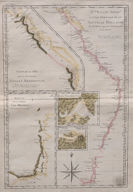
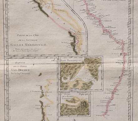
NLLE. GALLES MERIDLE. OU COTE ORIENTALE DE LA NOUVELLE HOLLANDE
Sold
Attractive and detailed map of East Coast of Australia published shortly after Cooks visit voyage 1768-1771
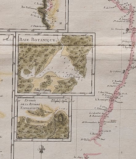
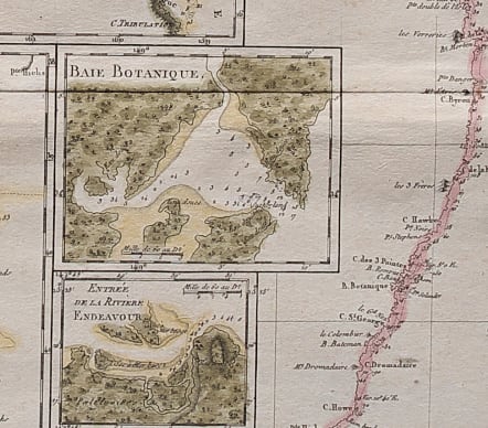
An interesting sheet showing the discoveries of Capt. Cook in Australia. The main map shows the whole of the east coast in fine detail, with soundings and the tracks of Cook's exploration. There are four insets: ‘Partie de la Côte de la Nouvelle Galles Méridionale’, ‘Esquisse de la Terre Van Diemen’, ‘Baie Botanique’ and ‘Entrée de la Rivièree Endeavour’.
The inset Baie Botanique is Botany Bay which is Sydney Harbour b with depths etc
Large compass rose at bottom.
Centre fold
Excellent hand colour
Very good condition for this reasonably rare map
code : M4201
Cartographer : BONNE Rigobert
Date : 1787 Paris
Size : 35*23 cms
availability : Sold
Price : Sold
Rigobert Bonne (1727-1795), a prolific French cartographer, was active between about 1760 and 1788, working in the French Hydrographical Office, and appointed as Hydrographer to the French King.
Bonne prepared a large number of charts, some of which appeared in the Atlas Maritime. Today, he is best known for the smaller maps that he prepared for Raynal’s Atlas de Toutes Les Parties Connues du Globe Terrestre, published in 1780, and the Atlas Encyclopedique, published in conjunction with Nicholas Desmarest. Although the maps are relatively plain, dispensing with the decorative embellishment of mid-century, they are detailed and provide good coverage of newly discovered regions.