ENGELLANDT
Sold
Early map of England and the British Isles. The map is oriented with west at the top and provides a fine early depiction of the British Isles, based upon Ortelius' map of 1570. Inset tablet lower right with German text.
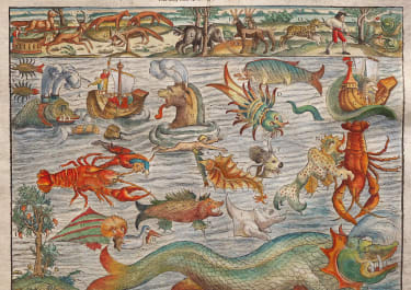
Three sea monsters and two sailing ships fill the empty space of the Oceans. A block-style title cartouche decorates the map. Mountains, villages, churches and woods are attractively drawn pictorially. Fine calligraphic lettering and highly detailed engraving. On one half of the backside is a decorative title and cartouche.
This charming map was published in the 1588-edition of Sebastian Munster's Cosmographia. After 1588, this map was only re-published in the German editions of the Cosmographia of 1592, 1598, 1614, and 1628 and is thus comparatively rare.
Excellent hand colour. Professionally repaired worm holes and laid down on Japanese archival paper
Good condition
code : M3189
Cartographer : Sebastian Munster
Date : 1588 Basel
Size : 31.0 x 36.0 cm.
availability : Sold
Price : Sold
Originally a scholar studying Hebrew, Greek and mathematics, Sebastian Munster (1489-1552) eventually specialised in mathematical geography and cartography. It was this double ability - as a classicist and mathematician - that was to prove invaluable when Munster set himself to preparing new editions of Solinus’ “Memorabilia” and Mela’s “De Situ Orbis”, two classical descriptive geographies containing maps, and his own two greatest works, the “Geographia” and “Cosmographia”. These reflect the widespread interest in classical texts, which were being rediscovered in the fifteenth century, and being disseminated in the later fifteenth and sixteenth century, through the new medium of printing.
The “Geographia” was a translation of Ptolemy’s landmark geographical text, compiled in about 150 AD., illustrated with maps based on Ptolemy’s calculations, but also, in recognition of the increased geographical awareness, contains a section of modern maps. In the first edition of the “Geographia”, Munster included 27 ancient Ptolemaic maps and 21 modern maps, printed from woodblocks. Subsequent editions of the “Cosmographia” were to contain a vast number of maps and plans.
One consequence of Munster’s work was the impetus it gave to regional mapping of Germany, but Munster was also the first cartographer to produce a set of maps of the four continents on separate maps. Most importantly, through his books (the “Geographia” and “Cosmographia” alone ran to over forty editions in six languages), Munster was responsible for diffusing the most up-to-date geographical information throughout Europe.