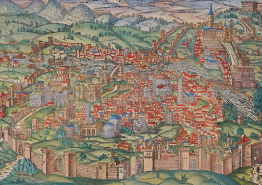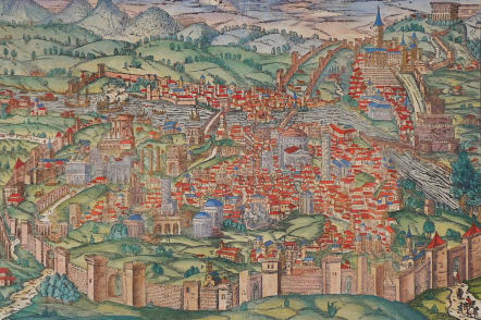
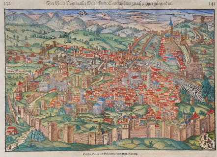
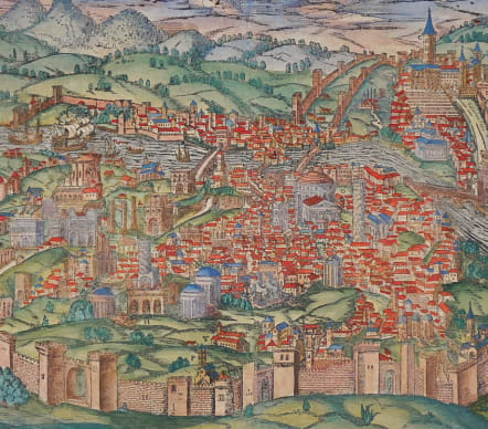
ROME DER STATT ROM
£575
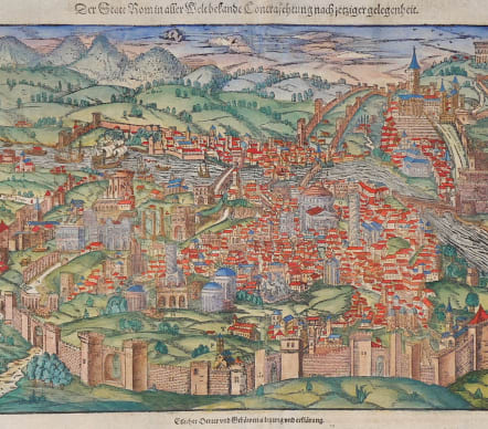
A large superb early woodcut view of Rome by Sebastian Munster on the full double sheet.
This is a great early plan view of 16th century Rome and the Vatican City.
Monuments of the ancient city, such as the Coliseum, the Pantheon and the aqueducts are also shown.
This is one of the best examples of this genuine antique vies that I have come across .
Beautiful hand colour
Very good condition
Engraver: Christoph Schweicker
References: Fauser - #11898
code : M5577
Cartographer : Sebastian Munster
Date : 1560c Basel
Size : 24.5*35.5 cms sheetsize 37*44 cms
availability : Available
Price : £575
Originally a scholar studying Hebrew, Greek and mathematics, Sebastian Munster (1489-1552) eventually specialised in mathematical geography and cartography. It was this double ability - as a classicist and mathematician - that was to prove invaluable when Munster set himself to preparing new editions of Solinus’ “Memorabilia” and Mela’s “De Situ Orbis”, two classical descriptive geographies containing maps, and his own two greatest works, the “Geographia” and “Cosmographia”. These reflect the widespread interest in classical texts, which were being rediscovered in the fifteenth century, and being disseminated in the later fifteenth and sixteenth century, through the new medium of printing.
The “Geographia” was a translation of Ptolemy’s landmark geographical text, compiled in about 150 AD., illustrated with maps based on Ptolemy’s calculations, but also, in recognition of the increased geographical awareness, contains a section of modern maps. In the first edition of the “Geographia”, Munster included 27 ancient Ptolemaic maps and 21 modern maps, printed from woodblocks. Subsequent editions of the “Cosmographia” were to contain a vast number of maps and plans.
One consequence of Munster’s work was the impetus it gave to regional mapping of Germany, but Munster was also the first cartographer to produce a set of maps of the four continents on separate maps. Most importantly, through his books (the “Geographia” and “Cosmographia” alone ran to over forty editions in six languages), Munster was responsible for diffusing the most up-to-date geographical information throughout Europe.