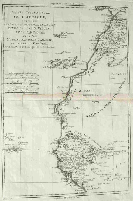
NORTH WEST AFRICA PARTIE OCCIDENTALE DE L'AFRIQUE CANARIES CAP VERD
£75
Interesting map of North West Africa from Marocco to Senegal with Cap Verde Islands and the Canary Islands.Uncoloured as issued.Good condition.code : M1157
Cartographer : BONNE Rigobert
Date : 1780 Paris
Size : 35*23cms
availability : Available
Price : £75
Rigobert Bonne (1727-1795), a prolific French cartographer, was active between about 1760 and 1788, working in the French Hydrographical Office, and appointed as Hydrographer to the French King.
Bonne prepared a large number of charts, some of which appeared in the Atlas Maritime. Today, he is best known for the smaller maps that he prepared for Raynal’s Atlas de Toutes Les Parties Connues du Globe Terrestre, published in 1780, and the Atlas Encyclopedique, published in conjunction with Nicholas Desmarest. Although the maps are relatively plain, dispensing with the decorative embellishment of mid-century, they are detailed and provide good coverage of newly discovered regions.