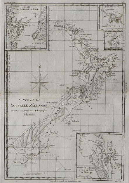
NEW ZEALAND NOUVELLE ZEELANDE
Sold
Uncommon map.
Attractive and important map of New Zealand showing cook's daily tracks around the Island, with 4 insets showing Mercure Bay, Cooks' Stait, Baye des Isles and Baye de Tolaga.
Finely engraved example of the fine detail appearing in Bonne's Atlas Supplement, following the explorations of Cook. Separate 18th Century maps of New Zealand are very scarce.
Very good condition
code : M2811
Cartographer : BONNE Rigobert
Date : 1787 Paris
Size : 36*24 cms
availability : Sold
Price : Sold
Rigobert Bonne (1727-1795), a prolific French cartographer, was active between about 1760 and 1788, working in the French Hydrographical Office, and appointed as Hydrographer to the French King.
Bonne prepared a large number of charts, some of which appeared in the Atlas Maritime. Today, he is best known for the smaller maps that he prepared for Raynal’s Atlas de Toutes Les Parties Connues du Globe Terrestre, published in 1780, and the Atlas Encyclopedique, published in conjunction with Nicholas Desmarest. Although the maps are relatively plain, dispensing with the decorative embellishment of mid-century, they are detailed and provide good coverage of newly discovered regions.