
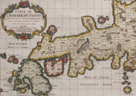
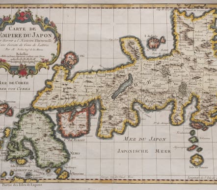
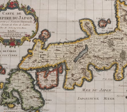
CARTE DE L'EMPIRE DU JAPON
£235
This is a reduced version of Bellin's influential map made for Jesuit Father Pierre-Francois-Xavier de Charlevoix's Histoire du Japon. Japan is presented basically on the Kaempfer/Scheuchzer model with several corrections to the coastlines, and individual provinces are delineated via engraved line. The Mer de Coree is shown to the west. The decorative rococo-style title cartouche includes two distance scales.
Very good hand colour
Mint condition
References: Hubbard #104.2; Walter OAG #101.
code : M5516
Cartographer : Jacques-Nicolas BELLIN
Date : 1752 Paris
Size : 22*32 cms sheet size 26*40 cms
availability : Available
Price : £235
Jacques-Nicolas Bellin (1703-1772) was one of the most important and prolific French cartographers of the mid-eighteenth century, in the service of the French Hydrographical Office. He was appointed the first Ingenieur Hydrographe de la Marine, and also Official Hydrographer to the French King.
Bellin was responsible for an enormous output of charts and maps. In a large folio format, he issued a volume of sea-charts of France, the Neptune Francois, and several sea-atlases of the World, including the Atlas Maritime and the Hydrographie Francaise. These large charts were amongst the best of the period and continued being reissued throughout the second half of the eighteenth century.
In smaller format, he issued the Petit Atlas Maritime (1764),which contained 580 detailed charts, as well as maps to illustrate l'Abbe Prevost's Histoire Generale des Voyages (1746-1757). Bellin also produced a substantial number of important separately issued maps, particularly reflecting continuing discoveries and political events in the Americas.


