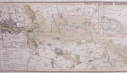
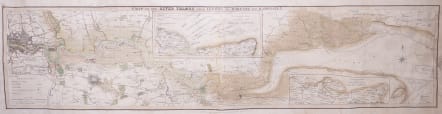
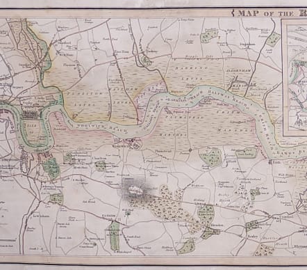
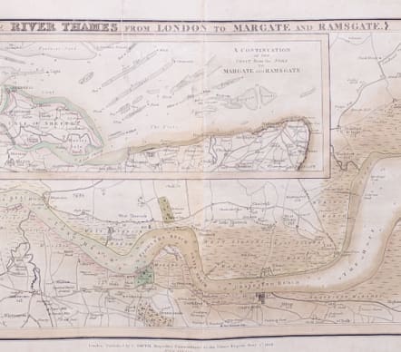
MAP OF THE RIVER THAMES FROM LONDON TO MARGATE AND RAMSGATE
Sold
Rare and detailed map chart of the Thames from London to the sea concentrating mainly on the Kent side with insets but also including Essex with Canvey and Southend .
Shows depths and sandbanks etc and the London Docks.
Detailed with roads etc in East and South East London.
By C Smith Mapseller Extraordinary to the Prince Regent..172 the Strand.
Charles Smith was a map and Globe seller who undertook a number of new maps of the British Isles with many Inland Navigation and Canals.
Original wash colour.Originally / Early Canvas backed .
Very slight staining
Otherwise very good condition for this Rare Map.
**REF Charles Smith P613 British Map Engravers Worls & Baynton-Williams
code : M4035
Cartographer : ANON
Date : 1818 London
Size : 27*100 cms
availability : Sold
Price : Sold