
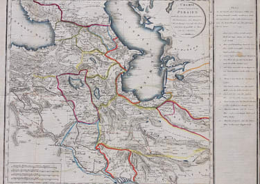
TABULA ITALIAE ANTIQUAE IN PROVINCIAS IET POPULOS DIVISA
£175
An attractive detailed and large historical map of Italy including the islands of Corsica and Sardinia, with a portion of Sicily and the Balearic Islands. The map is filled with Roman placenames and notations of early roads. Attributed by many to Blair who edited and published the Atlas it was engraved by Bayley. ;But the map is possibly by Kitchen.
Very good condition.
code : M2835
Cartographer : ANON
Date : 1785c London
Size : 44*58 cms
availability : Available
Price : £175

Middle East

Italy

France

South America


The Americas

British Isles


Middle East

Asia

Asia


Pacific & Australasia


France


Mediterranean & Islands

£175
Italy


World

France


£45
British Isles

Low Countries

£55
Pacific & Australasia

£135
British Isles

£125
France

£45
Italy

£50
France

£75
Scandinavia

£245
British Isles

£295
Russia

£395
France

£195
North America

£85
World

£75
Italy

Middle East

Middle East

Middle East

Middle East

British Isles


British Isles

£225
Middle East

£120
British Isles


£85
West Indies

France

£95
West Indies

Asia


France

£295
North America

North America

British Isles


Middle East

British Isles

Pacific & Australasia

North America

£125
North America

British Isles

Asia

Europe Continent

South America

World

Italy

France


France

British Isles

North America

Asia


North America


France

British Isles


£135
Italy


Africa

Pacific & Australasia

Greece

£35
France

British Isles

Pacific & Australasia


Scandinavia


North America

Italy

North America

France

Pacific & Australasia

France


British Isles

France

France

Africa

South America

Middle East

Asia
North America

South America
British Isles

France

Pacific & Australasia

Scandinavia

Italy


Pacific & Australasia

South America

France

France

South America

North America

South America


World

North America

North America

Russia

North America

British Isles


North America

France

France

Middle East


North America

Greece

British Isles


France

North America

West Indies


Pacific & Australasia

Africa

British Isles


Switzerland

North America


West Indies

France

France

Central America

Low Countries

North America

Africa

Africa


France

France

France

France

France

British Isles

Pacific & Australasia

British Isles


British Isles
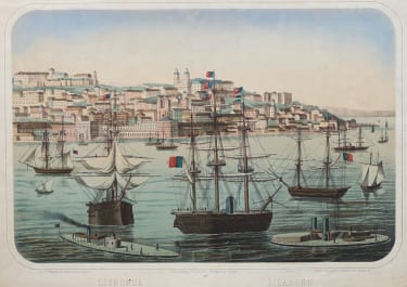
Spain & Portugal

France
Middle East