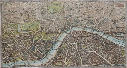
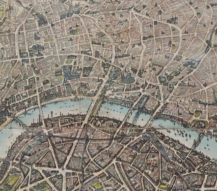
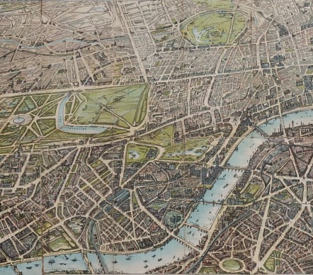
THE PICTORIAL PLAN OF LONDON CHAS BAKER
Sold
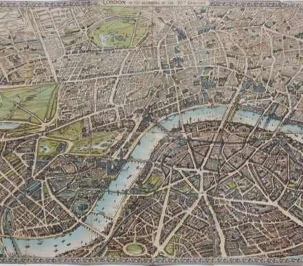
Or Londoin in the beginning of the twentieth century.
Scarce original colour lithgographic map of London.
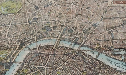
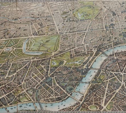
This map shows the area from Hyde Park to London Docks and from Regents Park to the Houses of Parliament in a bird’s eye view with drawings and illustrations of buildings, squares, landmarks, railways, underground railways, tramways and principal roads and thoroughfares.
This map was laid down on canvas in 1906.
Folding map with folds flattened. Originally trimmed into border in places to lay on to canvas.
Rare map in reasonably good condition
code : M5026
Cartographer : ANON
Date : 1906 London
Size : 42*69 cms
availability : Sold
Price : Sold

Middle East

Italy

France

South America


The Americas

British Isles


Middle East

Asia

Asia


Pacific & Australasia


France


Mediterranean & Islands

£175
Italy


World

France


£45
British Isles

Low Countries

£55
Pacific & Australasia

£135
British Isles

£125
France

£45
Italy

£50
France

£75
Scandinavia

£245
British Isles

£295
Russia

£395
France

£195
North America

£85
World

£75
Italy

Middle East

Middle East

Middle East

Middle East

British Isles


British Isles

£225
Middle East

£120
British Isles


£85
West Indies

France

£95
West Indies

Asia


France

£295
North America

North America

British Isles


Middle East

British Isles

Pacific & Australasia

North America

£125
North America

British Isles

Asia

Europe Continent

South America

World

Italy

France


France

British Isles

North America

Asia


North America


France

British Isles


£100
Italy


Africa

Pacific & Australasia

Greece

£35
France

British Isles

Pacific & Australasia


Scandinavia


North America

Europe Continent

Italy

North America

France

Pacific & Australasia

France


British Isles

France

France

Africa

South America

Middle East

Asia
North America

South America

Spain & Portugal

France

Pacific & Australasia

Scandinavia

Italy


Pacific & Australasia

South America

France

France

South America

North America

South America


World

North America

North America

Russia

North America

British Isles


North America

France

France

Middle East


North America

Greece

British Isles


France

North America

West Indies


Pacific & Australasia

Africa

British Isles


Switzerland

North America


West Indies

France

France

Central America

Low Countries

North America

Africa

Africa


France

France

France

France

France

British Isles

Pacific & Australasia

British Isles


British Isles

France