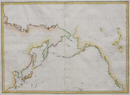


CARTE DES COTES DE L'AMERIQUE ET DE L'ASIE 1786 & 1787
£385
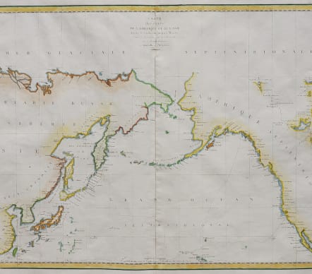
Full title: 'Carte des Côtes de l’Amérique et de l;Asie depuis la Californie jusqu’à Macao. d'après la Découverte faites en 1786 et 1787 pas les Frégates Francaises la Boussole et l'Astrolabe'.
Attractive and detailed first edition of this wall map map of the coastlines of Northwestern America and Northeastern Asia, from the first edition of La Perouse's Atlas du Voyage.
The map shows the tracks of the Boussolle and the Astrolabe along the coast of California, through to Mount St. Elias through Hawaii and along the coast of China, Korea, Japan and Kamchatka. Many place names along the West Coast. Interesting detail inland of Canada and Akaska lakes & river sysytems.
La Perouse's voyage was one of the major voyages of discovery in the Pacific in the last part of the 18th Century.
Many early place names on North America's west coast.
Excellent hand colour
Very good / Mint condition
code : M4894
Cartographer : ANON
Date : 1797 Paris
Size : 50*70 cms
availability : Available
Price : £385